AMG Mining Group

Our Assets
AMG have 2 assets in Mongolia
There are Altai Gold and Copper Mine & Shiirt Sharain Copper and Gold Mine located in the west of Mongolia.

Altai Gold and Copper Mine
Altai is accessible via sealed roads or by regular commercial flights from Ulaanbaatar, with a duration of about two hours. The Project is connected to Altai by a well-maintained gravel road between Altai and Taishir Soum, which is located about 45km to the north of the Project. The property is crossed by high voltage powerlines originating at a hydropower station on the Zavkhan River of Taishir. The Project consists of a mining licence and renewable up to 70 years
The licence covers an area of 7799 hectares, with the rich minerals as
gold, copper, iron, silver, zinc, lithium, oil and gas.

Shiirt Sharain Copper and Gold Mine
The Shiirt Sharain located on the territory of Asgat soum. Asgat is one of the administrative units (of 23 soums) within Zavkhan aimag. The Asgat soum is located at 185km to North of the provincial capital Uliastai, northwest of Mongolia and it is situated some 970 km to the West from Ulaanbaatar, capital of Mongolia. The region is characterized by a hill which stretch more than a kilometre where a gossan occurred over the hill. Major minerals such as copper are found aplenty in this gossanous hill.
The licence covers an area of 7045 hectares, with the rich minerals as copper, gold, zinc, silver, pb lead.
Altai Gold and Copper Mine
GOBI ALTAI
Altai is accessible via sealed roads or by regular commercial flights from Ulaanbaatar, with a duration of about two hours. The Project is connected to Altai by a well-maintained gravel road between Altai and Taishir Soum, which is located about 45km to the north of the Project. The property is crossed by high voltage powerlines originating at a hydropower station on the Zavkhan River of Taishir.
The Altai Gold (Altangadas) project is situated in the northern foothills of Khan Taishir Mountains at an elevation 1,970 to 2,090 m above sea level (asl) in the southwest sector of the licence area and on the margin of the Zavkhan basin, with elevations 1,860 to 1,910 m in the northern and eastern sector of the licence.
A major water reservoir exists above a hydropower plant on the Zavkhan River, about 45 km to the northeast of the Project. Several water bores with tanks and troughs are located across the licence area and provide water for livestock year-round.
Local vegetation is sparse steppe grasses, roseroot, and -in the foothills- Gentiana.
The climate conditions are hot dry summers (40°C in July), long cold winters (from November to February, with average daily temperatures ranging from -17 to -21°C), and strong winds in the spring and autumn. Annual precipitation averages approximately 200-300 mm, of which 80 mm is snow cover in winter.
The local infrastructure is reasonably well developed due to the licence area’s proximity to Altai. The Altangadas licence is situated a few kilometers north of the asphalted road connecting the city of Khovd, capital of the Khovd Province, located 420 km to the northwest, to Altai and the city of Bayankhongor approximately 390 km to the east. The licence is crossed by a well-maintained unpaved road from Altai to Taishir Soum, the local administrative centre, 45 km to the north. Altai is a province administrative centre with all services and regularly scheduled commercial flights. The local industry consists of herding, farming, and tourism. Mobile phone reception is limited on the property. High voltage power lines cross the property, extending from the 11 MW hydropower plant on the Zavkhan River at Taishir and connecting with the national grid of Altai.
The hydropower station of Taishir consists of a 190 m tall concrete gravity dam and a reservoir with a capacity of about one billion cubic metres of water at full supply level (Linard and Hansen, 2013). A plan is in development to build a 54 km pipeline to provide potable water to Altai. Any future milling/processing facility could potentially use water from the Taishir Reservoir, possibly involving only a short pipeline link from the planned Taishir-Altai pipeline. Alternatively, water may be present at a relatively shallow depth within or beneath the Quaternary cover on the eastern and western thirds of the property.

We have now a land size of 7799 hectares mining licence which was converted from exploration licence in January 2022. The mining licence is valid for an initial 30 years, with an expiration in 2052. After this initial period, the licence can be extended up to 70 years.
In the next 5 years, we intend to do a high-intensity exploration covering the whole licence and expect to have a highly favorable JORC resource by then. We have divided the tenement to 4 zones, which have different minerals for us to work on.
Our vision is to eventually build a sustainable mining town due to its proximity to Altai town. This mining town will consist of a complete mining industry with commercial lots, residential houses, schools, hospital, food market, and entertainment outlets.
HIGHLIGHTS
Altai Gold (Altangadas) project is located within a prospective gold-mineralized environment created by the conducive geological settings. Many exploration licenses have been issued in the surrounding areas. Khan Altai, a gold venture located about 80 km southeast of Altai City (40km southeast of Altangadas licence), has been developed into a viable mine with a reported gold resource of 85.4 tonnes. A CIL (carbon-in-leach) plant is already set up to process the gold ore.
A significant amount of exploration work has been carried out over the area including geological mapping, rock-chip sampling, diamond drilling and laboratory analyses. Four main targets have been identified, namely:
a. Greisen Target
b. Placer Gold Target
c. Orogenic Gold Target
d. Coal Target
To date, only the Greisen Target and the Placer Gold Target have been investigated by drilling.
Recent drilling by Realxoin Resources , comprising 21 holes and 5360 meters sunk over the Greisen Target confirms that the area is gold-mineralized. It is opined that the gold mineralization is deep-seated, and hence further work on this target is needed.
Extensive pitting amounting to 157 holes over the Placer Gold Target returns several interesting gold values. The blocky nature of the sediments and gold grains recovered from the Placer Target suggests that the gold source is nearby. Since the placer valley drains the Orogenic Gold area, the latter’s gold potential is implied. Many grab samples returned with high gold values of more 6 g/t and there is one which is as high as 138 g/t.
Within the Orogenic Gold Target, numerous quartz veins, some with strike lengths of between 200-500 m, and some as vein-swarms, were documented. A few of these quartz veins were previously worked upon by artesian miners. Even though only limited sampling of the quartz veins was done, some encouraging gold values grading up to 0.8 g/t were recorded.
In late 2022, Realxoin Resources commissioned Geofile Engineering LLC to undertake a magnetic and pole-dipole electrical survey over the project site. Three magnetic anomalies were delineated, and they correlate well with the high chargeability and low resistivity anomalies derived from the pole-dipole electric survey. These magnetic anomalies are deemed to be created by underlying haematite/magnetite and other base-metal sulphide.
The Competent Person opines that two mineral targets are very encouraging and deserve immediate attention, namely:
a. The magnetite anomalies: a large iron ore deposit is indicated.
b. The Orogenic Gold Target: possess good potential for gold mineralization.
Currently, a comprehensive Altangadas geophysics have been mapped out and completed in August 2023 together with a detailed 1000 rock samples. A planned 2000 m, 7 holes drilling program already mobilized for September this year and will be observed by SRK Mongolia, a JORC consultant company. We hope to hit some good high value hard-rock gold and have an attractive indicated reserve.
There is also a Mongolian potential gold resource estimated and is based solely on the exhaustive research carried out by Mr O Chuluun, a state-certified consultant engineer/geologist as well as the former Director of Geological Resource Department of Mongolia. Mr Chuluun identified a total of 5 gold mineral zones with total potential placed at 29.2 tonnes of gold, as presented below:
Gold Mineral Potential (Kg)
Khangina 15,210kg
Gashuun 930kg
Tsakhiurt 550kg
Tsoin Tolgol 9,750kg
Jinger 263kg
Greisen 1,430kg
Tomort 1,079kg
Total 29,212kg
In summary, Altai Gold (Altangadas) project constitutes an excellent prospect, and has potential for developing into a highly profitable mine. Hence, a further investigation work is highly recommended where these work includes exploratory drilling of both the iron ore and the gold targets, drill-core sampling and assays, laboratory test-works. The company intends to public list it’s shares in the Stock Exchange to raise sufficient funds for a massive 40,000 to 50,000 meters drilling exploration for 2026 and expect development and production to be in 2028.
Shiirt Sharain Copper and Gold Mine

Zavkhan, Western Mongolia
Shiirt is the property name with an exploration licence located in Asgat soum of Zavkhan, Western Mongolia. The sized of the property is 7045 hectares and the region is characterized by a hill which stretch more than a kilometre where a gossan occurred over the hill. Major minerals such as copper are found aplenty in this gossanous hill.
Property description and location
The Shiirt Sharain exploration licence located on the territory of Asgat soum. Asgat is one of the administrative units (of 23 soums) within Zavkhan aimag. The Asgat soum is located at 185km to North of the provincial capital Uliastai, northwest of Mongolia and it is situated some 970 km to the West from Ulaanbaatar, capital of Mongolia.
Local resources and infrastructure
Infrastructure support in terms of power is available at soum center Asgat which link to the Mongolian Power grid. Its electricity is powered from Taishir hydroelectric station in Govi-Altai. In Asgat, internet and mobile coverage is available with mobile telephone operators. High school and kindergarten, hospital, cultural center with a 250 seating capacity, museum, restaurants and retail shops and even a bank branch operated by KHAN Bank is available.
Highlight
The Geologic settings of the Western Mongolia is very complex, with rocks dating back >600 million years (protozoic) age, and have undergone several phases of tectonic movement and faultings. The prominent fault structure is the one trending Northwest-Southeast.
The two main mineral targets have been identified via geological investigations including geological mapping, rock-chip sampling. They are:
- The Sharain Khudag skarn polymetallic mineralization
- The sericite-alunite-kaoline alternation zone located to the northeast of Sharain Khudag.
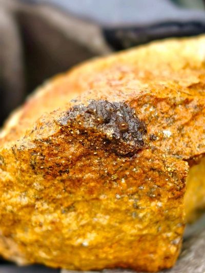
A prominent gossanous hallo occurs over a small hill at Sharain Khudag, covering an area in excess of one acre. Secondary copper ore consisting of abundant malachite and some azurite abounds within the gossanous zone. Rock-chip samples returns high values of copper, zinc and silver, and also lead and gold to a lesser extent.
Previous drill-holes were sunk over the anomalous zone as evident from the existing drill-hole collars still standing at the site. Although the drill-records are not available, a documented summary of the assay records shows excellent metal grades with copper ranging up to 4.18%, zinc up to 11% and silver up to 1,000 g/t.
Realxoin Resources LLC commissioned Erdenyn Erel to undertake a reconnaissance survey and assessment prior to taking an interest in the project. A field trip was carried out in mid May 2021, and 12 rock-chip samples were taken across the skarn occurrence of Sharain Khudag. The assay results obtained were very encouraging and complimented the previous results obtained by the original owner.
Subsequent to acquiring 60% interest in the project, Realxoin Resources LLC commissioned Goodlife Engineering LLC to undertake an elaborate pole-dipole electrical survey exercise over the project site in year 2022. A distinct stock shaped anomaly was noted over the Sharain Khudag area, with good correlations with the geological settings and the previous identified mineral zone. The dimension of the anomaly is at least 220 m long, up to 22 m width and extent down at least 300 m deep.
The Consultant opines that this target is very encouraging and has excellent potential to be developed into a viable mine. Preliminary estimates based on various assumptions made suggest that the mineral resource is in the range of 4.62 million tonnes, with good grades of copper, zinc and silver. The latest rock-chip samples indicated average grades of the three prominent metals to be 0.56% Cu, 0.95% zinc and 50 g/t silver.
The estimated overall metal grades were derived from both the old records as well as the more recent sampling done by Erdenyn Erel. The resultant estimated copper grade is 1.33%, zinc at 3.25% and silver at 275 g/t. Grab samples were also taken back in 2022 by the owners and a team of geologist who visited the site for lab analysis both in SGS lab in Mongolia and Malaysia and have shown very high copper content of 107,710 ppm and gold 0.25 ppm. The gossanous hill are covered with abundant of copper oxide turquoise rocks and is literally a turquoise hill.
As of June 2023, a full Induced Polarization (IP) survey and Magnetic Mapping have been completed and the drilling exploration are planned for 2024. With the intention to public list the company shares in ASX, Australia, the company will be able to raise the funds for it’s exploration and development of the mine.
In summary, the Shiirt Zavkhan tenements is an excellent prospect, and has potential for development into a viable mine. Further investigation work is highly recommended. Further work comprises two phases of diamond drilling, drill-core sampling and assays, laboratory test-work of metal recoveries, more detailed geological mapping and sampling.
Expert Mining Consulting
Our experienced consultants provide expert advice and guidance to make informed decisions. We work closely to identify and resolve any challenges.
Mining Safety and Training
At AMG Mining Group, we utilize cutting-edge technology to enhance our mining processes. Our team is committed to implementing innovative techniques that not only improve efficiency but also prioritize environmental sustainability. We ensure that our methods are safe and effective, allowing us to extract resources with minimal impact on the surrounding ecosystem. Safety is our top priority. We provide comprehensive training and resources to ensure all workers are equipped to work safely and efficiently in your mining operation.